
News From Nowhere Radical & Community Bookshop
not-for-profit - a workers'co-op - committed to social justice | 96 Bold Street, Liverpool L1 4HY - 0151 708 7270
Alan Godfrey Maps - Facsimiles of old local Ordnance Survey Maps.
Related categories:
Related booklists: Liverpool History,
Books are listed in order of year of publication - newest titles are at the top. There are 4 books in this booklist
-
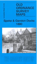
Speke & Garston Docks 1890. Lancashire Sheet 113.16a (Facsimile of old Ordnance Survey Map) - by Introduction by Kay Parrott
£3.50 other format (2021) - ISBN 13: 9781787214354 | ISBN 10: 1787214354
Detailed map of Speke; Lancashire sheet 113.16 Historical introduction by Kay Parrott Double-sided map and includes sheet 114.13 Covers Garston Plantation, St Michael's Schools, Canterbury Hotel, All Saint's Church, Speke Town Farm and Church Miss ... more
View book details -
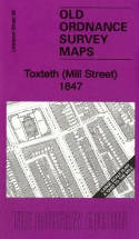
Toxteth (Mill Street) 1847. Liverpool Sheet 39 (Facsimile of old Ordnance Survey Map) - by Introduction by Kay Parrott
£3.50 other format (2012) - ISBN 13: 9781847845580 | ISBN 10: 1847845584
This very detailed map covers part of the Toxteth Park area. Coverage stretches from Grafton Street eastward to Berkley Street, and from Upper Stanhope Street southward to Northumberland Street. Features include St Patrick's RC Chapel, St ... more
View book details -
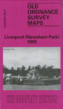
Liverpool (Newsham Park) 1905. Lancashire Sheet 106.11 (Facsimile of old Ordnance Survey Map) - by Introduction by Kay Parrott
£3.50 other format (1991) - ISBN 13: 9780850544534 | ISBN 10: 085054453x
This detailed map and busy map covers the area of north Liverpool around and to the south of Newsham Park. The map includes the eastern part of Everton, and other districts include Fairfield, Elm Park, Kensington Ward and Low Hill Ward. Coverag ... more
View book details -
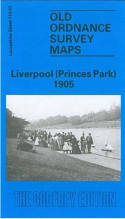
Liverpool (Princes Park) 1905. Lancashire Sheet 113.03 (Facsimile of old Ordnance Survey Map) - by Introduction by Naomi Evetts
£3.50 other format (1991) - ISBN 13: 9780850544121 | ISBN 10: 0850544122
This map covers a busy area of south Liverpool, largely comprising the eastern half of Toxteth, Princes Park Ward and Sefton Park. Coverage stretches from Admiral Street eastward to Green Bank, and from Eversley Street southward to Alexandra Drive. ... more
View book details
© News From Nowhere Co-operative Ltd IP24524R 2004-2025 | Privacy policy | Contact | return to top of page