
News From Nowhere Radical & Community Bookshop
not-for-profit - a workers'co-op - committed to social justice | 96 Bold Street, Liverpool L1 4HY - 0151 708 7270
Allerton 1905. Lancashire Sheet 113.04 (Facsimile of old Ordnance Survey Map)
by Introduction by Kay Parrott - £3.50 Alan Godfrey Maps (1990)
other format
ISBN 13: 9780850545456 | ISBN 10: 0850545455
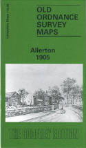
This detailed map covers the Allerton Road area, on the SE side of Liverpool, plus the southern part of Wavertree.
Coverage stretches from Greenbank Road eastward to Hornby Lane, and from Dunbabin Road southward to Elmsley Road. The western half of the map shows suburban streets developing, further east the area is more rural but with numerous villas in leafy grounds. Features include Holy Trinity church, trams and depot, Richmond Lodge, Blue Coat Hospital, quarries, LNWR railway with Sefton Park station, Penketh Hall, Mossley House, brick works, Allerton Road Farm, All Hallows church, Hart Hill, Dunbabin Farm, Calderstone, Bishop Eton monastery, Liverpool Polo Ground, Stand Park, etc. On the reverse we include street directory entries for Crawford Avenue, Nicander Road, Penny Lane Wavertree, Smithdown Road.
This map links up with sheet 106.16 Wavertree to the north, 113.03 Princes Park to the west, 114.01 Gateacre to the east and 113.08 Mossley Hill to the south.
(Price & availability last checked: July 2023)
© News From Nowhere Co-operative Ltd IP24524R 2004-2025 | Privacy policy | Contact | return to top of page