News From Nowhere Radical & Community Bookshop
not-for-profit - a workers'co-op - committed to social justice | 96 Bold Street, Liverpool L1 4HY - 0151 708 7270
Wavertree & Broadgreen 1905. Lancashire Sheet 106.16 (Facsimile of old Ordnance Survey Map)
by Introduction by Kay Parrott - £3.50 Alan Godfrey Maps (1990)
other format
ISBN 13: 9780850543384 | ISBN 10: 085054338x
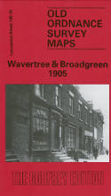
This detailed map covers the area of east Liverpool around Wavertree and Broad Green. Coverage stretches from Stevenson Street eastward to Rocky Lane, and from Binns Road southward to Fir Lane.
Features include Victoria Park, east Wavertree, Wavertree Nook, Broad Green, Olive Mount, Oak Vale Park, Sandown Park, Olive Mount Junction, Broad Green station, Rathbone Road goods station, Pighue Lane Junction, St Mary's church, Sandown Hall, Wavertree Green, School for Blind Children, Cottage Homes, Broad Green Hall, Rocky Lane Farm, Childwall Priory, Hillside Farm, tramways, etc.
The eastern half of the map, around Childwall Road and Broad Green Road, is surprisingly rural. On the reverse we include street directory entries for Binns Road, Broad Green Road, Chesnut Grove, Wavertree High Street, Orford Street, Rathbone Road, Sandown Lane.
This map links up with sheet 106.12 Old Swan to the north, 106.15 Edge Hill to the west, 107.13 Childwall to the east, 113.04 Allerton to the south.
(Price & availability last checked: July 2023)
© News From Nowhere Co-operative Ltd IP24524R 2004-2025 | Privacy policy | Contact | return to top of page